Tag Archives: Google Maps

Microsoft and Google go head to head over tracking Santa

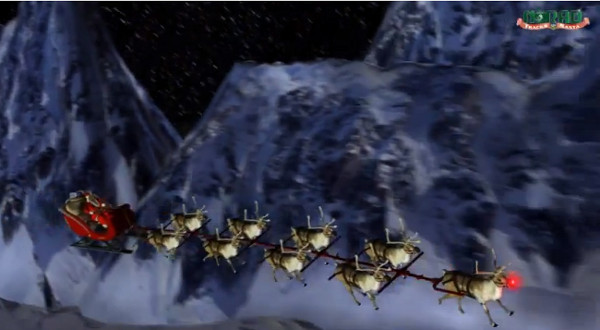
NORAD, the North American Aerospace Defense Command, and its predecessor, the Continental Air Defense Command (CONAD) has been tracking Santa since 1955. It all began when a Colorado Springs-based Sears Roebuck & Co. advertisement misprinted the telephone number for children to call Santa. The phone number put the children through to the CONAD Commander-in-Chief’s operations hotline. The Director of Operations at the time, Colonel Harry Shoup, had his staff check the radar for indications of Santa making his way south from the North Pole. Children who called were given updates on his location and the Santa Tracker was born.

NORAD now uses four high-tech systems to track Santa – radar, satellites, Santa Cams and fighter jets. The Santa Cams “are ultra-cool, high-tech, high-speed digital cameras that are pre-positioned at many locations around the world. NORAD only uses these cameras once a year. The cameras capture images and videos of Santa and his reindeer as they make their journey around the world”. Full technical details of all four systems can be found on the NORAD Santa site at http://www.noradsanta.org/en/how.html.

2012 NORAD Santa Tracker
2012 NORAD Tracks Santa (HD) – YouTube : https://www.youtube.com/watch?v=jb0gj_sIBdg

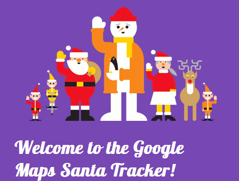
In 2007 Google became an official NORAD Tracks Santa partner and provided the maps that displayed real time information on Santa’s location. This year, that partnership ended and NORAD is now using Microsoft’s Bing Maps. In response Google has launched its own Santa Tracker at http://www.google.com/santatracker/. It will be interesting to see how it compares with NORAD’s but straight away I have to query the quality of Google’s pre-launch information. On the “Learn more” page at http://www.google.com/santatracker/about.html the image shows not Santa as the central figure but a large snowman. Surely some mistake?

Google Santa Tracker Learn More

Google is also trying to push Google+ as the main source of information with up to the minute reports being posted on +Googlemaps at https://plus.google.com/+GoogleMaps/posts

At the time of writing this post lift off was just 15 minutes away so you still have time to get a ring side seat with the tracer of your choice:

The original NORAD tracker http://www.noradsanta.org/

Google Santa Tracker http://www.google.com/santatracker/

Google maps UK canals

First cycle routes and now canals. Google is collaborating with the Canal and River Trust to provide a Google Map guide to the UK’s canal network called In Your Area (http://canalrivertrust.org.uk/in-your-area). It is not available as part of the standard Google Maps. The map allows you to enter your address or postcode to find the nearest canal. The map shows the locations of canals, canal locks and bridges and also volunteering opportunities, places to eat and drink and boating services and moorings.

Canal and River Trust Google Map of waterways

It is early days and not everything is marked up on the map, or at least it isn’t for the Kennet and Avon Canal in Reading. Also planned for later this year is the addition of  ‘Street View’ images of the canal and river network. (Please, no lurking in the bushes by the side of the tow paths and pushing the Google cycles into the canal!)

Google adds cycling routes to UK maps

Google has added cycle routes and directions to its UK maps. The feature has been available on US and Canadian maps since 2010 but has now been extended to the Europe and Australia. In the UK Google has been working with Sustrans (http://www.sustrans.org.uk/) to include bike trails, lanes and recommended roads. Set your starting point and destination as usual and the directions area on the screen should include a bicycle icon in addition to the car, public transport and walking icons.

Google Maps cycle option


Select a suggested route and as well as text instructions it will be outlined in blue on the map. The “bicycling layer” also shows trails (dark green lines), dedicated lanes (light green lines) and bicycle friendly roads (dotted green lines). Google came up with two routes from my house to Reading Railway Station. The first more direct one followed the roads.

Google Maps cycle route


The second suggestion took the scenic route along the river, which would be more pleasant and probably safer during the rush hour.

Google Maps cycle route


The directions come with the usual warning that they are in beta and that you should use caution. There is an option to report unmapped bike routes, streets that aren’t suited for cycling, and other problems.

Further information is available on Google Lat Long: Biking directions expands into Europe and Australia (http://google-latlong.blogspot.co.uk/2012/07/biking-directions-expands-into-europe.html. The Guardian Bike Blog has tested out a couple of routes in London (Google Maps’ cycle routes: just how good are they?  http://www.guardian.co.uk/environment/bike-blog/2012/jul/12/google-maps-uk-cycle-routes?) and set up a Twitter hashtag #cycletest for cyclists to comment on the routes they have tried.

Google Transit takes the scenic route

I travel a lot for both business and leisure and I use public transport whenever possible. The plus side to this is that if it is a longish journey – for example Reading to Manchester – I can settle down on the train and get on with some work. The down side is that I have to know my way around the transport networks, not just in the UK but also in the other countries I visit. After over 20 years of business travel I have a range of tools and timetables bookmarked on my laptop plus the really useful stuff inside my head gained from experience. For example, the easiest route is not always the quickest: a single cross country stopping train may take longer but the seemingly quicker alternative of three changes can be seriously stress inducing and take longer if there are delays, signals failures, “incidents” and you miss your connections. I recently spotted that two of my clients link to Google Transit (http://www.google.com/transit) on their map and directions pages so I thought I would give it a go. You do not have to go to the Google Transit page to start using this; if you are already on Google Maps and are looking for directions from A to B, choose the middle “By public transport” icon. So let’s try a journey from Reading railway station to Milton Keynes.


Google Transit


Well I didn’t expect that: a 3 hour journey using 3 buses. Running the journey through the Google Transit page itself the journey time increases to around 3.5 hours and the number of buses to 4.


Google Transit


Google is well known for giving different results for the same type of search depending on the route you take but I was perplexed by Google’s insistence that I have to travel by bus. OK, it’s Saturday so there are probably engineering works and buses are probably the best option. I checked the National Rail web site (http://www.nationalrail.co.uk/):


National Rail


No problem it seems. My train journey via London would take just under 2 hours. Perhaps bus transport is Google’s default option? Underneath the ‘B’ location is ‘Add Destination – Show options’. Click on this and from the ‘Prefer’ box you can choose Any mode of public transport, Bus, Underground, Train, Tram/Light rail. The box underneath offers Best route (no definition as to what ‘best’ means), Fewer transfers, Less walking. No matter what combination of options I selected Google insisted that bus is the only option.


Google Transit Options


Perhaps Google is confused by the cross-London element of my journey even though Underground is one of the ‘Prefer’ options. Let’s look at a simpler journey: Reading to Crowthorne. I frequently travel along this route and it is a straightforward journey by rail taking 14 minutes as confirmed by National rail.


National Rail Crowthorne


Google, however, insists that it requires two buses and 1.5-2 hours!


Google Directions Crowthorne


I tried other routes and it seems that Google, in the UK at least, thinks that public transport means bus despite the ‘Prefer’ options it offers. This could be useful, though, if there is a rail strike and you need to identify alternative means of transport. Or you could go straight to Traveline (http://traveline.info/).

Google adds estimated fuel cost to Maps

Google has added estimated fuel cost to driving directions in its Google Maps.I would never have picked this up had Techradar.com not covered it as we gave up having our own car years ago and Google does not appear to have advertised this feature in the obvious places.

If you want to go from A to B and are using Google maps, choose  the driving directions as usual and Google gives you the estimated fuel cost at the bottom of the directions.

Google Maps Fuel Costs

In this case Google tells me that it would cost someone 29 pence to drive from Reading railway station to where I live in Star Road. If you want to see how Google has calculated that then click on the Est. fuel cost link.

Google Fuel Costs

The default for vehicle type is standard. The other two options are Compact and High Consumption. Fuel type by default is petrol but you can change it to …erm.. just diesel. So no LPG, nor is there any differentiation between unleaded and super unleaded, diesel and premium diesel. Neither is it clear where the price has come from, and if you change the fuel type the fuel price does not change. You can, though, change the price manually.

To check the local prices of all types of fuel go to Petrolprices.com. (See my 2005 posting at http://www.rba.co.uk/wordpress/2005/11/18/see-cheapest-uk-petrol-prices-for-free/)

Petrol Prices UK

At best the trip from the railway station to my road in a compact car that uses LPG would cost 12 pence. At worst and using a high consumption care with the most expensive fuel the cost would be 55 pence.

Of course this is never going to be totally accurate, so it is useful only as a general indication of the likely cost of  your journey. As I no longer drive my own car I am not the best person to comment on this aspect. But it does seem to me that you have to fiddle around rather a lot with the settings before Google gives you anything that remotely resembles the true cost. I would be interested in comments from regular drivers on how helpful – or not – this addition to Google Maps is.

Flightradar24 – watch air traffic live

Flightradar24.com shows live aircraft traffic in the airspace above Europe, of which there has been very little over the past few days. It is a mashup of Google Maps, airport locations, broadcast air traffic data and photos of some of the aircraft.

It uses data a flight information system called ADS-B (Automatic Dependent Surveillance-Broadcast) and this data is provided by a network of 100 volunteers equipped with ADS-B receivers, most of whom are in Europe. Not all aircraft are picked up; only about 60% of passenger planes and only a few military and private planes have an ADS-B transponder. A list of aircraft models that are visible and those that are not can be found at http://www.flightradar24.com/about.php.

Major airports are marked on the map with a blue cross and the position of airplanes with – erm – airplane icons.

Flightradar24 Map
Image courtesy of Flightradar24


Flightradar24 plane and flight information
Image courtesy of Flightradar24

Click on a plane and the path that it has taken is displayed. The colour of the trail behind the plane shows the altitude the aircraft had at that position. (An explanation of the trail colours is at http://www.flightradar24.com/about.php).

Additional information on the flight appears on the right of the screen and includes – when available – flight number, airline, the type of plane, altitude, speed, where the flight took off and destination. For many of the Scandinavian airlines’ planes there are also photos and  for some planes you can view their recent flight history.

On a technical note this site relies heavily on the use of  javascript so to get the best out of this site users are advised to use Firefox or Google Chrome.

Other issues to bear in mind are that even for Europe coverage is not 100% and, most important of all, it is seriously addictive!

Google Street View covers most of UK

Google Street View now covers most of the UK. When I last looked at Caversham and Reading on March 9th they were not covered. Today they are! Looking at various pieces of evidence – for-sale signs, new buildings or lack of them, and the progress of exterior refurbishment – the photos in my part of Caversham were taken about 15 months ago.

Google Maps has yet to tell UK users to get on their bike, though. We currently have directions for travelling between two locations on foot and by car but in the United States there are now cycling directions for 150 cities. Those of us in the UK do not have “public transit” directions on Google Maps either but we do have http://www.transportdirect.info/, which I notice now has a cycle planner for selected areas. This is the first version of the planner produced in conjunction with Cycling England, Ordnance Survey and relevant local authorities. Transport Direct is looking for feedback from users so if you regularly cycle, and your area is covered, give it a go at http://www.transportdirect.info/Web2/JourneyPlanning/FindCycleInput.aspx